


Tropical Storm Albertothe first named storm of the Atlantic hurricane seasonis bringing rain, wind and possible flooding to parts of Texas as it moves deeper into Mexico.
The storm has already been blamed for three deaths in Mexico. Authorities said they expect the powerful system, which is expected to bring up to 50 centimeters of rain to some parts of Mexicoit could alleviate drought in the region as it moves west.
Maps show the storm’s predicted path as it moves slowly through Mexico.
Where is Tropical Storm Alberto headed?
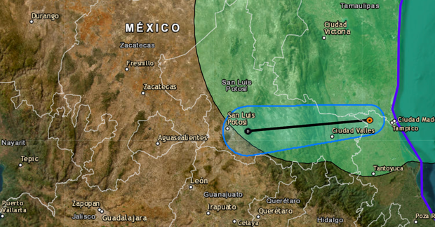
The National Hurricane Center’s forecast shows Tropical Storm Alberto continuing westward through Mexico, where it made landfall Thursday morning. The storm is expected to continue inland as the day progresses.
National Hurricane Center
The storm is moving at a speed of about 13 miles per hour, the hurricane center said in a briefing, with maximum sustained winds of 45 miles per hour. As of Thursday morning, Tropical Storm Alberto was about 25 miles west of Tampico, Mexico, and 250 miles south of Brownsville, Texas. Rain fell on both sides of the border.
Tropical Storm Alberto is expected to dissipate as it moves across Mexico, the NHC said, predicting the storm will clear by Thursday or overnight.

Getty Images
Fifty-one Texas counties are under disaster declarations as the storm moves through Mexico.
Where will Tropical Storm Alberto bring rain and flooding?
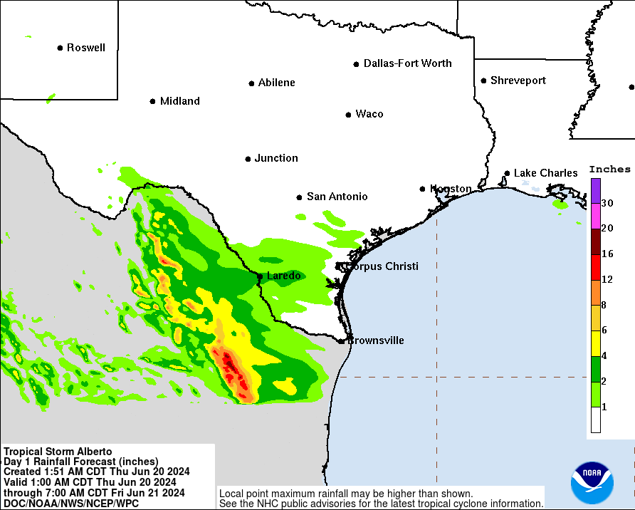
Maps from the National Hurricane Center show Alberto raining in Mexico and parts of Texas. Photos and videos show flooded streets in the region. Wind and flooding conditions are expected to improve throughout the day, especially in Galveston and Corpus Christi.
Parts of Mexico near Tamaulipas could see between 12 and 16 inches of rain, according to the NHC. Wider areas of the country, including much of the Veracruz and Oaxaca regions, are expected to see up to ten centimeters of rain.
National Hurricane Center/NOAA
In the United States, the worst rain was expected near Laredo, Texas. The border town is in a region predicted to receive up to ten centimeters of rain. Other parts of the state, including areas near Corpus Christi and San Antonio, could see up to two inches of rain.
National Hurricane Center/NOAA
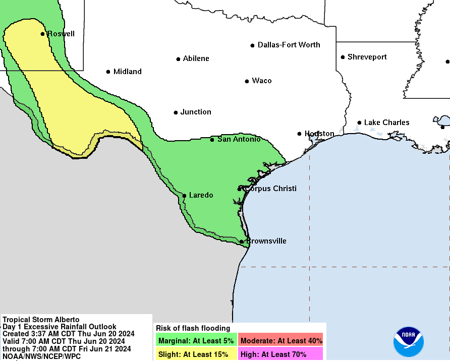
Other parts of Texas were prepared for storms and flooding. Much of the Texas border and southeast coast has at least a 5% chance of flash flooding, according to the NHC. In the Roswell area, there is at least a 15% risk of such flooding.
National Hurricane Center/NOAA
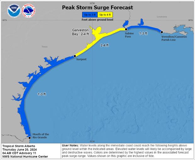
Along the East Coast of Texas, areas are bracing for storm surges of at least a foot. Between Sargent and the mouth of the Rio Grande, the NHC predicted a storm surge of between one and four feet. A similar storm is expected between Sabine Pass and Vermilion/Cameron Parish Line. For the coastal area of Galveston Bay, the risk is even greater, with the NHC predicting a storm surge of between 60 and 1.20 meters.
National Hurricane Center/NOAA
bol co
jogo de terror online
novela sbt ao vivo
wishlist
musica terra seca
taça png


